Top Bar
  • About
  • Careers
  • Contact
  • About
  • Careers
  • Contact
Search Area
    • About BWSR Grants
      • Apply for BWSR Grants
      • Frequently Used Acronyms
      • Grant Information & Resources
      • Grants Quarterly Newsletter
    • Resources for Grantees
      • eLINK
      • Grants Administration Manual
      • Landscape Resiliency & Climate Change
        • Alliance to Advance Climate-Smart Agriculture
        • BWSR Climate Resiliency Toolbox
        • Carbon Sequestration: Conservation Practices and Programs
      • What’s Working for Conservation
      • Vegetation Establishment & Management
        • Native Vegetation and Biodiversity Collaborative
        • Native Vegetation Establishment and Enhancement Guidelines
        • Seed Mixes
        • Native Plant ID and Information
      • Restoring Conservation Lands
      • Overview
      • Programs
      • Easement Forms
      • RIM Handbook & Guidance
      • Existing Easements
      • SWCD Resources
        • Contacts
        • RIM Interactive Map
        • Geospatial Resources
        • Conservation Lands by County
        • Online Learning
        • RIM Rundown
        • Easement Alteration Policy
      • Living Landscapes Initiative
        • Lawns to Legumes: Your Yard Can BEE the Change
        • Pollinator Pathways Grants
        • Habitat Friendly Utilities Program
        • Habitat Enhancement Landscape Program (HELP)
        • Pollinator and Biodiversity Toolbox
          • Community Outreach
        • Managing Invasives for a Resilient Landscape
        • Minnesota Habitat Friendly Solar Program
        • Community Conservation
      • Lawns to Legumes
      • Pollinator Pathways
      • Habitat Friendly Utilities
        • What to Plant in Buffers
      • Minnesota Buffer Law
      • Buffer Establishment & Management Toolbox
      • Guide to the Buffer Compliance Process
        • Step 1: SWCD Compliance Review
        • Step 2: Landowner Notification
        • Step 3: Notice of Non-Compliance
        • Step 4: Corrective Action Notice Sent
        • Step 5: Issuing Enforcement Action
        • Step 6: Parcel is Compliant
      • Implementation Guidance
        • Average Buffer Widths
        • Buffer Measurement for a Public Drainage Ditch
        • Building Better Buffers
        • Compliance Determinations
        • Conservation Reserve Program Exemption Guidance
        • Determining Normal Water Level
        • Determining the Top or Crown of a Bank for Land Adjacent to a Public Water
        • Haying and Grazing of Buffers
        • Vegetation Establishment Goals
      • Procedures
        • Procedure 1: Compliance Determinations (Parcel and Bank Approach)
        • Procedure 2: Reporting and Progress Tracking
        • Procedure 3: MS4 Exemption
        • Procedure 4: Alternative Practices
        • Procedure 5: Other Alternative Practices Approved by the Board
        • Procedure 6: Local Water Resources Riparian Protection ("Other Watercourses")
        • Procedure 7: Failure to Implement
        • Procedure 8: Election of Jurisdiction
        • Procedure 9: BWSR's Review of County and Watershed District Buffer Rules, Ordinances and Official Controls
      • Alternative Practices
        • Alternative Practices Introduction
        • Common Alternative Practice #1: Minnesota Agricultural Water Quality Certification Program
        • Common Alternative Practice #2: NRCS Filter Strip Standard: MN 393/391 Practice Standards - Public Waters
        • Common Alternative Practice #3: Grassed Waterway/Cultivated Watercourses - Public Waters
        • Common Alternative Practice #4A: Negative Slopes or Concentrated Inflow - Public Ditches
        • Common Alternative Practice #4B: Glacial Lake Plain Areas - Public Ditches
        • Common Alternative Practice #5: Negative Slopes or Concentrated Inflow - Public Waters
        • Common Alternative Practice #6: Conservation Tillage/Cover Crops With Vegetated Filter Strip - Public Waters
        • Decision Support Tool
      • Election of Jurisdiction
      • Enforcement
      • Compliance Tracking Tool (BuffCAT)
      • Buffer Program Update
      • Contacts
      • Soils & Soil Health
        • Model Soil Loss Ordinance
        • Tillage and Erosion Survey Project
        • Soil Health Practices Grant
      • Daily Erosion Project
      • Working Lands Resources
      • Agricultural Lands
      • Forest Land
      • Peatlands
      • One Watershed, One Plan
        • One Watershed, One Plan Participating Watersheds
        • One Watershed, One Plan Policies
        • One Watershed, One Plan Resources
        • One Watershed, One Plan Videos
      • Metro Watershed Management Plan
        • Metro State Agencies Review Roster
        • Metro Update
      • Watershed District Management Plan (non-metro)
        • Amendments and Extensions
        • Development and Revision
      • Metro County Groundwater Plan
      • SWCD Comprehensive Plans
      • Planning Information
      • Working with State Agencies
        • State Agency Review Roster for County Water Plans and Watershed Management Plans
      • Water Storage & Climate Resilience
      • Groundwater Protection
      • Urban Stormwater Management
      • Prioritize, Target, and Measure Application (PTMApp)
      • Water Quality Tools & Models
      • Drainage in Minnesota
        • Understanding Minnesota Public Drainage Law
        • Other Drainage Resources
      • Minnesota Public Drainage Manual
      • Drainage Work Group
      • Drainage Management Team
      • Drainage Records Modernization
      • Chapter 103E Ditch Buffer Strip Reporting
      • Multipurpose Drainage Management
      • Wetlands Regulation in Minnesota
      • Wetland Conservation Act (WCA) Contacts
      • Joint Application Form
      • WCA Forms & Templates
      • WCA Program Guidance & Information
        • WCA Topics of the Week
      • WCA Rulemaking
        • WCA Rulemaking Comments Received
      • WCA Program Reports
      • 404 Assumption
      • Wetland Bank Credits and Fees
      • Wetland Bank Transaction Forms
      • Wetland Bank Guidance and Information
      • Local Government Road Wetland Replacement Program
      • Agricultural Wetland Bank
      • In-Lieu Fee Mitigation Program
      • Wetland Bank & Mitigation Easements
      • Wetland Delineation
      • Wetland Functional Assessment
      • MN Wetland Restoration Guide
      • Minnesota Stream Quantification Tool and Debit Calculator
      • Minnesota Wetland Professional Certification Program Information
      • Wetland Training Schedule and Registration
        • MWPCP Class Portal
      • Wetland Training Resources
      • Online Learning Library & Archive
      • Training Calendar
      • Technical Training and Certification Program
        • Area Technical Training Teams
        • Conservation Planning
        • Core Competency
        • Job Approval Authority
        • Technical Training Individual Development Plan (IDP) Tool
        • Technical Training Resources
      • MN Wetland Professional Certification Program Information
      • BWSR Academy
        • 2026 BWSR Academy
        • 2025 BWSR Academy
        • 2024 BWSR Academy
      • BWSR Spring Training
      • Training Updates
      • Successful Outreach Strategies
      • Performance Review and Assistance Program (PRAP) Grants
        • PRAP Grants
        • Conservation Project Planning and Promotion
          • Inspections
        • Invasive Species Control
        • Native Vegetation
        • Pollinator Habitat
        • Prairie, Savanna, Forest and Agricultural Projects
        • Stormwater, Shoreline and Wetland Projects
      • Standard Reviews & Checklists
        • FY25 Conservation Reserve Program State Incentives Grant Program
      • PRAP Legislative Reports
    • About BWSR
      • What We Do
      • Board
      • BWSR Executive Leadership
      • Staff
      • Strategic Plan
        • Engagement Process
      • Diversity, Equity and Inclusion
      • Affirmative Action Plan
      • Legislative Resources
      • Careers
      • Contact Us
    • About Our Partners
      • Soil and Water Conservation Districts
      • Watershed Districts
      • Watershed Management Organizations
      • Counties
      • Cities and Townships
      • Regional Partnerships
    • News & Publications
      • Subscribe
      • News Releases
      • BWSR Story Library
      • Conservation Stories
      • BWSR Snapshots
        • Snapshots Archive
      • Featured Plant
        • Featured Plant Archive
      • Reports

Search

  1. Home
  2. Search

Virtual Panel of Experts: Native Seed Mix Design for Wet Sites

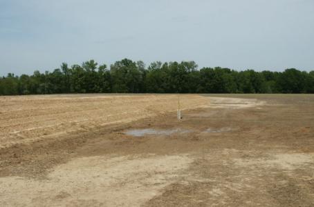
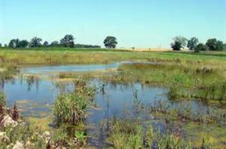
This training introduces the core principles for designing and evaluating diverse native seed mixes for wet sites, including wetlands, shorelines, and riparian areas. Participants will explore how hydrology, soil conditions, seed biology, and site history influence plant selection and establishment, with an emphasis on building resilient, biodiverse plant communities that support water quality and wildlife. The session also highlights practical strategies for selecting species, determining seeding rates, and assessing existing mixes, while recognizing the need for adaptive management and multiple restoration approaches beyond seeding alone. This session is led by Karin Jokela who is joined by three panelists - Rob Baden, Alex Galt and Jeff Potts - that have been long time practitioners of wet site restoration.

Subject TTCP
Basic Tech Skills (Matrix)
Skill
Vegetation – Species, Seeding and Seed Mixes
Format
Webinar
Source

TTCP, Xerces

Time
147 minutes
Training Type
Online Learning
Online Location
Native Seed Mix Design for Wet Sites

Tech Talk: Critical Area Planting

Tech Talk replay from April 6, 2020. Kelly Voigt reviews the PS342 Critical Area Planting Implementation Requirements and examples.

Subject TTCP
Basic Tech Skills (Matrix)
Skill
Practice Specific
Format
Webinar
Source

TTCP

Time
1:08:05
Training Type
Online Learning
Location

United States

Notes

Reference Materials:

  • PS342 Implementation Requirements with Training Notes
  • Critical Area Planting Design Resources
  • Example Exercises
Related Practices & Terms

342, Practice Standard, Implementation Requirements

Online Location
Tech Talk: April 6, 2020

Tech Talk: Connecting High Tunnels to Soil Health

Shannon Carpenter, NRCS, and Julie Grossman, UMN provide an overview of the High Tunnel practice standard (CPS 325), review different types of high tunnels, and discuss the planning considerations with a focus on high tunnel resource concerns and supporting conservation practices.

Skill
Practice Specific
Format
Webinar
Source

TTCP, UMN

Time
86 minutes
Training Type
Online Learning
Location

United States

Notes

Presentation

Related Practices & Terms

325, High Tunnel System

Online Location
Tech Talk: August 30, 2021

Tech Talk: Livestock Watering System Planning

Jeff Duchene, NRCS Grazing Lands Specialist, covers the planning considerations for livestock watering systems. Topics covered include identifying water sources and considerations for ensuring water sources have the potential to supply adequate water for the planned herd size, overview of pipe installation methods, overview of water tank materials, sizing water tanks, and considerations for placement of water tanks within the grazing system. Examples of watering system layouts are provided.

Subject TTCP
Livestock
Skill
Practice Specific
Source

TTCP

Time
112 Minutes
Training Type
Online Learning
Location

United States

Notes

Presentation

Related Practices & Terms

Livestock, Pipeline, Watering Systems, Watering Facility, Water Well, 516, 614, 642

Online Location
Tech Talk: April 26, 2021

Tech Talk: Calculating Stocking Rates

Lance Smith, NRCS Rangeland Specialist, shows how to calculate stocking rates by considering forage production, herd needs, and the management of the grazing system.

Subject TTCP
Basic Tech Skills (Matrix)
Skill
Managed Grazing Systems
Format
Webinar
Source

TTCP

Time
32:56
Training Type
Online Learning
Location

United States

Notes
  • Presentation
Related Practices & Terms

528, Prescribed Grazing, Livestock, Forage, Stocking

Online Location
Tech Talk: October 5, 2020 am

Soils Training Resources

This is a collection of video, webinar, and presentation training resources related to soils: mapping, classification, interpretations, GIS data, and many more.

Subject TTCP
Soil
Format
Reference Material
Source

NRCS

Training Type
Online Learning
Location

United States

Notes

Soils Training Resources

Wetland Restoration

This training will enable field staff involved in project applications, the design, or the construction of wetland restorations to have a solid understanding of the science and methods used. Types of implementation will include mostly basic components such as scrapes, ditch plugs, and small embankments. NRCS and SWCD staff that follow up this training with experience on actual projects should be able to pursue Job Approval Authority for the phase(s) they work on.

Skill
Practice Specific
Format
Webinar
Source

TTCP

Training Type
Online Learning
Location

United States

Notes

Part 1

  • Training Replay (130 minutes)
  • Presentations:
    • What is a wetland?
      • Parameters
      • Functions and Values
      • HGM
    • Wetland Restoration Overview
    • Project Goals and Outcomes
    • Engineering Site Assessment
      • In the Office
      • In the Field
    • Concept Plans
    • Handout - Resources

Part 2

  • Training Replay (146 minutes)
  • Engineering Restoration Design Presentations
    • Tile Drained Wetlands
    • Ditch Drained Wetlands
    • Ditch Plugs/Earthen Embankments
    • Wetland Excavations
    • Drainage Lift Stations
    • Wetland Outlets
  • Example Project

Part 3

  • Training Replay (109 minutes)
  • Presentations:
    • Vegetation Site Assessment
    • Vegetation Species Selection
    • Planning Considerations for Seeding

Homework

  • Training Replay (115 minutes)
  • Homework Assignment 1
  • Homework Assignment 2
  • Homework Assignment 1 Concept Plan
  • Homework Assignment 2 Concept Plan
Related Practices & Terms

Wetland Restoration, Functions, Values, Hydrogeomorphic, HGM, 657, 643, 327

Tech Talk: Native Plant Communities

Megan Benage and Becky Marty from the DNR present on Native Plant Communities. This workshop session covers a tour of the Native Plant Communities Field Guides including key features, how to key things out and pitfalls to using the guide and applying its information. The session also includes plant characteristics and how to key things out for Plant ID. In addition, you will find out how you can use the information contained in the Native Plant Community guidebooks in your job with prairie and forest examples.

Subject TTCP
Basic Tech Skills (Matrix)
Skill
Native Vegetation, Habitats and Pollinators
Format
Webinar
Source

TTCP, DNR

Time
113 Minutes
Training Type
Online Learning
Location

United States

Notes
  • Field Guide electronic copies of maps, summaries, and fact sheets can be found here.
  • A list of online resources can be found here.
  • Three sections of the replay can be accessed via the Table of Contents
Related Practices & Terms

Native Plants, Vegetation

Online Location
Tech Talk: May 17, 2021

Technical Training Resources Archive


Partner Logo

New Employee Training Guide

This document is intended to guide new staff through introductory training during their first 90 days on the job.

          TTCP Training Guide

Training Tracks (Skills)

These Training Tracks are a collection of resources pertaining to specific skills. Each Track is a structured guide outlining training recommendations categorized by skill level.

         Herbaceous Vegetation Establishment

         Hydrology and Hydraulics

         Managed Grazing Systems

         Soil Health and Management

Training Series (Practices)

These Training Series are a collection of resources pertaining to specific practices. They are currently available for the most commonly requested training needs identified through the Individual Development Plan process, but additional offerings will be available in the future.

We need your help to keep these trainings up to date. Each Training Series contains links to other training offerings and resources, both internal and external. If a link is broken, outdated, or just isn't working right please let us know!

Conservation Cover - CPS 327

Cover Crop - CPS 340

Critical Area Planting - CPS 342

Filter Strip - CPS 393

Forest Stand Improvement - CPS 666

Grassed Waterway - CPS 412

Grazing Management - CPS 528

Livestock Pipeline and Watering Facility - CPS 516 & CPS 614

Nutrient Management - CPS 590

Pasture and Hayland Planting - CPS 512

Pest Management Conservation System - CPS 595

Residue and Tillage Management, No Till - CPS 329

Tree/Shrub Establishment - CPS 612

Water and Sediment Control Basin - CPS 638

Wetland Restoration - CPS 657

Windbreak/Shelterbelt Establishment and Renovation - CPS 380

Nutrient Management Module 2: Planning for Sensitive Features

This self-paced material regarding sensitive features for nutrient management planning includes:

  • What are the resource concerns?
  • Why do we develop nutrient management plans and sensitive feature setback maps?
  • What makes a feature sensitive for nutrient management?
Subject TTCP
Nutrient Management
Skill
Practice Specific
Format
Reference Material
Source

TTCP

Training Type
Online Learning
Location

United States

Notes

This session is part the Nutrient Management (PS590) training track, and other sessions can be found in the Online Learning page.

Nutrient Management Module 2: Planning for Sensitive Features (pdf)

Related Practices & Terms

590, Nutrient Management, Planning, Sensitive Features, Setback

Pagination

  • First page « First
  • Previous page ‹ Previous
  • Page 352
  • Page 353
  • Page 354
  • Page 355
  • Current page 356
  • Page 357
  • Page 358
  • Page 359
  • Page 360
  • Next page Next ›
  • Last page Last »

Useful Links

  • BWSR Maps and Apps Gallery
  • Careers
  • eLINK
  • Staff
  • Subscribe
  • Webmaster Email

Connect with Us


Clean water land and legacy amendment program logo

BWSR's work is supported by Clean Water
Land and Legacy Amendment Funding

MN Board of Water and Soil (known as BWSR) logo

BWSR agency programs that assist landowners and local government have resulted in less sediment and nutrients entering our lakes, rivers, and streams; more fish and wildlife habitat; and the drastic slowing of wetland losses.

The Board of Water and Soil Resources is an equal opportunity employer.

Main Address:
520 Lafayette Road North
St Paul, MN. 55155
Phone: 651-296-3767
TTY: 800-627-3529
Email: info.BWSR@state.mn.us

BWSR Office Locations


© Copyright 2026 Minnesota Board of Water and Soil Resources

Accessibility   |   Affirmative Action Plan   |   Download Adobe Acrobat Reader   |   Sitemap