Top Bar
  • About
  • Careers
  • Contact
  • About
  • Careers
  • Contact
Search Area
    • About BWSR Grants
      • Apply for BWSR Grants
      • Frequently Used Acronyms
      • Grant Information & Resources
      • Grants Quarterly Newsletter
    • Resources for Grantees
      • eLINK
      • Grants Administration Manual
      • Landscape Resiliency & Climate Change
        • Alliance to Advance Climate-Smart Agriculture
        • BWSR Climate Resiliency Toolbox
        • Carbon Sequestration: Conservation Practices and Programs
      • What’s Working for Conservation
      • Vegetation Establishment & Management
        • Native Vegetation Establishment and Enhancement Guidelines
        • Seed Mixes
        • Native Plant ID and Information
      • Restoring Conservation Lands
      • Overview
      • Programs
      • Easement Forms
      • RIM Handbook & Guidance
      • Existing Easements
      • SWCD Resources
        • Contacts
        • RIM Interactive Map
        • Geospatial Resources
        • Conservation Lands by County
        • RIM Rundown
        • Easement Alteration Policy
      • Living Landscapes Initiative
        • Lawns to Legumes: Your Yard Can BEE the Change
        • Pollinator Pathways Grants
        • Habitat Friendly Utilities Program
        • Lawns to Legumes Partner Resources
        • Habitat Enhancement Landscape Program (HELP)
        • Pollinator and Biodiversity Toolbox
          • Community Outreach
        • Managing Invasives for a Resilient Landscape
        • Minnesota Habitat Friendly Solar Program
        • Community Conservation
      • Lawns to Legumes
      • Pollinator Pathways
      • Habitat Friendly Utilities
        • What to Plant in Buffers
      • Minnesota Buffer Law
      • Buffer Establishment & Management Toolbox
      • Guide to the Buffer Compliance Process
        • Step 1: SWCD Compliance Review
        • Step 2: Landowner Notification
        • Step 3: Notice of Non-Compliance
        • Step 4: Corrective Action Notice Sent
        • Step 5: Issuing Enforcement Action
        • Step 6: Parcel is Compliant
      • Implementation Guidance
        • Average Buffer Widths
        • Buffer Measurement for a Public Drainage Ditch
        • Building Better Buffers
        • Compliance Determinations
        • Conservation Reserve Program Exemption Guidance
        • Determining Normal Water Level
        • Determining the Top or Crown of a Bank for Land Adjacent to a Public Water
        • Haying and Grazing of Buffers
        • Vegetation Establishment Goals
      • Procedures
        • Procedure 1: Compliance Determinations (Parcel and Bank Approach)
        • Procedure 2: Reporting and Progress Tracking
        • Procedure 3: MS4 Exemption
        • Procedure 4: Alternative Practices
        • Procedure 5: Other Alternative Practices Approved by the Board
        • Procedure 6: Local Water Resources Riparian Protection ("Other Watercourses")
        • Procedure 7: Failure to Implement
        • Procedure 8: Election of Jurisdiction
        • Procedure 9: BWSR's Review of County and Watershed District Buffer Rules, Ordinances and Official Controls
      • Alternative Practices
        • Alternative Practices Introduction
        • Common Alternative Practice #1: Minnesota Agricultural Water Quality Certification Program
        • Common Alternative Practice #2: NRCS Filter Strip Standard: MN 393/391 Practice Standards - Public Waters
        • Common Alternative Practice #3: Grassed Waterway/Cultivated Watercourses - Public Waters
        • Common Alternative Practice #4A: Negative Slopes or Concentrated Inflow - Public Ditches
        • Common Alternative Practice #4B: Glacial Lake Plain Areas - Public Ditches
        • Common Alternative Practice #5: Negative Slopes or Concentrated Inflow - Public Waters
        • Common Alternative Practice #6: Conservation Tillage/Cover Crops With Vegetated Filter Strip - Public Waters
        • Decision Support Tool
      • Election of Jurisdiction
      • Enforcement
      • Compliance Tracking Tool (BuffCAT)
      • Buffer Program Update
      • Contacts
      • Soils & Soil Health
        • Model Soil Loss Ordinance
        • Tillage and Erosion Survey Project
        • Soil Health Practices Grant
      • Daily Erosion Project
      • Working Lands Resources
      • Agricultural Lands
      • Forest Land
      • Peatlands
      • One Watershed, One Plan
        • One Watershed, One Plan Participating Watersheds
        • One Watershed, One Plan Policies
        • One Watershed, One Plan Resources
        • One Watershed, One Plan Videos
      • Metro Watershed Management Plan
        • Metro State Agencies Review Roster
        • Metro Update
      • Watershed District Management Plan (non-metro)
        • Amendments and Extensions
        • Development and Revision
      • Metro County Groundwater Plan
      • SWCD Comprehensive Plans
      • Planning Information
      • Working with State Agencies
        • State Agency Review Roster for County Water Plans and Watershed Management Plans
      • Water Storage & Climate Resilience
      • Groundwater Protection
      • Urban Stormwater Management
      • Prioritize, Target, and Measure Application (PTMApp)
      • Water Quality Tools & Models
      • Drainage in Minnesota
        • Understanding Minnesota Public Drainage Law
        • Other Drainage Resources
      • Minnesota Public Drainage Manual
      • Drainage Work Group
      • Drainage Management Team
      • Drainage Records Modernization
      • Chapter 103E Ditch Buffer Strip Reporting
      • Multipurpose Drainage Management
      • Wetlands Regulation in Minnesota
      • Wetland Conservation Act (WCA) Contacts
      • Joint Application Form
      • WCA Forms & Templates
      • WCA Program Guidance & Information
        • WCA Topics of the Week
      • WCA Rulemaking
        • WCA Rulemaking Comments Received
      • WCA Program Reports
      • 404 Assumption
      • Wetland Bank Credits and Fees
      • Wetland Bank Transaction Forms
      • Wetland Bank Guidance and Information
      • Local Government Road Wetland Replacement Program
      • Agricultural Wetland Bank
      • In-Lieu Fee Mitigation Program
      • Wetland Bank & Mitigation Easements
      • Wetland Delineation
      • Wetland Functional Assessment
      • Wetland Restoration
      • Minnesota Stream Quantification Tool and Debit Calculator
      • Minnesota Wetland Professional Certification Program Information
      • Wetland Training Schedule and Registration
        • MWPCP Class Portal
      • Wetland Training Resources
      • Online Learning Library & Archive
      • Training Calendar
      • Technical Training and Certification Program
        • Area Technical Training Teams
        • Conservation Planning
        • Core Competency
        • Job Approval Authority
        • Technical Training Individual Development Plan (IDP) Tool
        • Technical Training Resources
      • MN Wetland Professional Certification Program Information
      • BWSR Academy
        • 2026 BWSR Academy
        • 2025 BWSR Academy
        • 2024 BWSR Academy
      • BWSR Spring Training
      • Training Updates
      • Successful Outreach Strategies
      • Performance Review and Assistance Program (PRAP) Grants
        • PRAP Grants
        • Conservation Project Planning and Promotion
          • Inspections
        • Invasive Species Control
        • Native Vegetation
        • Pollinator Habitat
        • Prairie, Savanna, Forest and Agricultural Projects
        • Stormwater, Shoreline and Wetland Projects
      • Standard Reviews & Checklists
        • Vision for Native Vegetation and Biodiversity
        • FY25 Conservation Reserve Program State Incentives Grant Program
        • MN Wetland Restoration Guide
      • PRAP Legislative Reports
    • About BWSR
      • What We Do
      • Board
      • BWSR Executive Leadership
      • Staff
      • Strategic Plan
        • Engagement Process
      • Diversity, Equity and Inclusion
      • Affirmative Action Plan
      • Legislative Resources
      • Careers
      • Contact Us
    • About Our Partners
      • Soil and Water Conservation Districts
      • Watershed Districts
      • Watershed Management Organizations
      • Counties
      • Cities and Townships
      • Regional Partnerships
    • News & Publications
      • Subscribe
      • News Releases
      • BWSR Story Library
      • Conservation Stories
      • BWSR Snapshots
        • Snapshots Archive
      • Featured Plant
        • Featured Plant Archive
      • Reports

Search

  1. Home
  2. Search

Tech Talk: Connecting High Tunnels to Soil Health

Shannon Carpenter, NRCS, and Julie Grossman, UMN provide an overview of the High Tunnel practice standard (CPS 325), review different types of high tunnels, and discuss the planning considerations with a focus on high tunnel resource concerns and supporting conservation practices.

Skill
Practice Specific
Format
Webinar
Source

TTCP, UMN

Time
86 minutes
Training Type
Online Learning
Location

United States

Notes

Presentation

Related Practices & Terms

325, High Tunnel System

Online Location
Tech Talk: August 30, 2021

Carbon Sequestration: Conservation Practices and Programs

Carbon dioxide (CO2), a greenhouse gas, is increasing in atmospheric concentration due to human activities, such as burning of fossil fuels and land use changes. Trees, grasses, and other plants remove CO2 from the atmosphere, and the carbon is accumulated - or sequestered - in stable forms such as biomass and soil organic carbon.

How does carbon sequestration work?

Through photosynthesis, plants convert atmospheric CO2 into starches and structural components, thereby storing carbon in their tissues. Dead and decomposing plant materials are incorporated into the soil where the carbon is stored as soil organic matter. Carbon sequestration removes CO2 that would otherwise contribute to climate change from the atmosphere.

Knowing which conservation practices sequester carbon is the key to getting the most return on practices that yield other benefits, such as reducing soil erosion and improving water quality. State and federal conservation programs provide landowners with incentives to implement various conservation practices that sequester carbon.

Conservation Tillage and Cover Crops
Conservation tillage in combination with cover crops can be effective in storing soil carbon
Forests
Forests are well-known sinks for atmospheric carbon.
Grasslands
Prairie systems contain much more soil organic carbon than other ecosystems due to rooting characteristics of the vegetation that grows there.
Wetlands
Wetlands sequester carbon from the atmosphere through plant photosynthesis and by acting as sediment traps for runoff. Wetlands also emit methane, a potent greenhouse gas.

BWSR Highlights Importance of Water Storage at Climate Week Event

MOWER COUNTY, Minn. – The Minnesota Board of Water and Soil Resources (BWSR) joined local government partners today in Mower County to celebrate Climate Week by highlighting the important role water storage can play in addressing the effects of climate change.

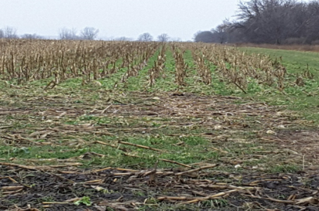
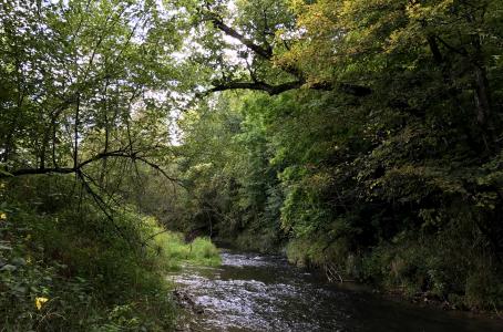
The state is experiencing more frequent and intense rainfall events, resulting in negative impacts to agriculture and infrastructure, significant erosion along riverbanks, and declining water quality. The state Legislature passed bipartisan legislation this year allocating $2 million to BWSR to develop a water storage program that will provide assistance to local governments to control water rates, protect infrastructure, improve water quality, and mitigate climate change impacts.

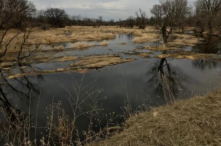
“Water storage projects like this site in Mower County can help address these problems by slowing down and temporarily holding back water from re-entering a stream or river after a significant rainfall,” BWSR Executive Director John Jaschke said.

The Mower County site features a dam that functions along a 2,000-foot-long embankment. A low flow pipe reduces the frequent 2–5-inch rains by 80-95%, allowing significant water quality improvements by reconnecting the floodplain via the embankment and pipe. Project benefits include water quality improvements and flood reduction on 1,240 acres of drainage area.

Governor Tim Walz issued a proclamation declaring September 20-26 as Climate Week in Minnesota. BWSR’s water storage program is part of a statewide effort to take action on climate change. Gov. Walz directed state agencies to engage Minnesota residents to find solutions that reduce greenhouse emissions, build community resilience, and create jobs. Share your ideas by visiting climate.state.mn.us

eLINK Guidance: Reporting MinnFARM Pollution Reduction Estimates

  • Read more about eLINK Guidance: Reporting MinnFARM Pollution Reduction Estimates

Tech Talk: Riparian Herbaceous Cover or Riparian Forest Buffer?

Shannon Carpenter, NRCS State Water Quality Specialist, reviews the Riparian Herbaceous Cover (CPS 390) and Riparian Forest Buffer (CPS 391). This session covers the differences in resource concerns, intended purposes, and determining which practice is more appropriate for the site.

Skill
Practice Specific
Format
Webinar
Source

TTCP

Date
September 24, 2021
Time
60 minutes
Training Type
Online Learning
Location

United States

Related Practices & Terms

390 Riparian Herbaceous Cover, 391 Riparian Forest Buffer

Online Location
Tech Talk: Sept 20, 2021

MN CREP for Landowners

The Minnesota Conservation Reserve Enhancement Program (MN CREP)

Update from May 16, 2025: The first batching period of calendar year 2025 will be held May 16 – June 6, 2025. Contact your local Soil and Water Conservation District for more information.

  • Read more about MN CREP for Landowners

The Social Science of Conservation (Phase I, Webinar #2)

This 3-phase, webinar-based training series is designed to teach basic principles of conservation economics to enable participants to integrate economics into the NRCS Conservation Planning Process. Participants will become more knowledgeable about the role economics plays and will be able to recognize and perform basic economic analysis during conservation planning. This course will discuss economic awareness, alternatives development using an economic lens, economic tools, and additional concepts related to economic and social variables to help the planner when identifying and discussing economic effects with the client.

Skill
Conservation Planning
Format
Webinar
Source

NRCS

Date
September 24, 2021
Time
52 minutes
Training Type
Online Learning
Location

United States

Notes

This is one module in a 12 module training series that satisfies the Conservation Economics requirement for becoming a Level III certified planner. Register and record your learning progress in Aglearn (https://aglearn.usda.gov/course/view.php?id=57778)to receive credit toward Conservation Planner Certification. Instructions for adding level I and level III planner programs in AgLearn can be found at: https://app.box.com/s/ana74l4jzsobtlnsmu6c7aipfukne02f

Related Practices & Terms

Level III Conservation Planner

Online Location
The Social Science of Conservation (Phase I, Webinar #2)

Integrating Economics into Conservation Planning (Phase I, Webinar #4)

This 3-phase, webinar-based training series is designed to teach basic principles of conservation economics to enable participants to integrate economics into the NRCS Conservation Planning Process. Participants will become more knowledgeable about the role economics plays and will be able to recognize and perform basic economic analysis during conservation planning. This course will discuss economic awareness, alternatives development using an economic lens, economic tools, and additional concepts related to economic and social variables to help the planner when identifying and discussing economic effects with the client.

Skill
Conservation Planning
Format
Webinar
Source

NRCS

Date
September 24, 2021
Time
30 minutes
Training Type
Online Learning
Location

United States

Notes

This is one module in a 12 module training series that satisfies the Conservation Economics requirement for becoming a Level III certified planner. Register and record your learning progress in Aglearn (https://aglearn.usda.gov/course/view.php?id=57778)to receive credit toward Conservation Planner Certification. Instructions for adding level I and level III planner programs in AgLearn can be found at: https://app.box.com/s/ana74l4jzsobtlnsmu6c7aipfukne02f

Related Practices & Terms

Level III Conservation Planner

Online Location
Integrating Economics into Conservation Planning (Phase I, Webinar #4)

Conservation Project Planning and Promotion

  • Read more about Conservation Project Planning and Promotion

Pagination

  • First page « First
  • Previous page ‹ Previous
  • Page 115
  • Page 116
  • Page 117
  • Page 118
  • Current page 119
  • Page 120
  • Page 121
  • Page 122
  • Page 123
  • Next page Next ›
  • Last page Last »

Useful Links

  • BWSR Maps and Apps Gallery
  • Careers
  • eLINK
  • Staff
  • Subscribe
  • Webmaster Email

Connect with Us


Clean water land and legacy amendment program logo

BWSR's work is supported by Clean Water
Land and Legacy Amendment Funding

MN Board of Water and Soil (known as BWSR) logo

BWSR agency programs that assist landowners and local government have resulted in less sediment and nutrients entering our lakes, rivers, and streams; more fish and wildlife habitat; and the drastic slowing of wetland losses.

The Board of Water and Soil Resources is an equal opportunity employer.

Main Address:
520 Lafayette Road North
St Paul, MN. 55155
Phone: 651-296-3767
TTY: 800-627-3529
Email: info.BWSR@state.mn.us

BWSR Office Locations


© Copyright 2026 Minnesota Board of Water and Soil Resources

Accessibility   |   Affirmative Action Plan   |   Download Adobe Acrobat Reader   |   Sitemap