BWSR announces 2020 Outstanding Watershed District Employee
St. Paul, Minn.— Minnesota Board of Water and Soil Resources (BWSR) Executive Director John Jaschke presented the 2020 Outstanding Watershed District Employee award today to Prior Lake-Spring Lake Watershed District Water Resources Project Manager Maggie Karschnia. The recognition took place during the Minnesota Association of Watershed Districts’ (MAWD) annual conference, held virtually this year.
“Local staff is key to effective conservation delivery in Minnesota,” Jaschke said. “Maggie Karschnia’s dedication to preserving our water resources is commendable, and we appreciate all she does to further resource conservation.”
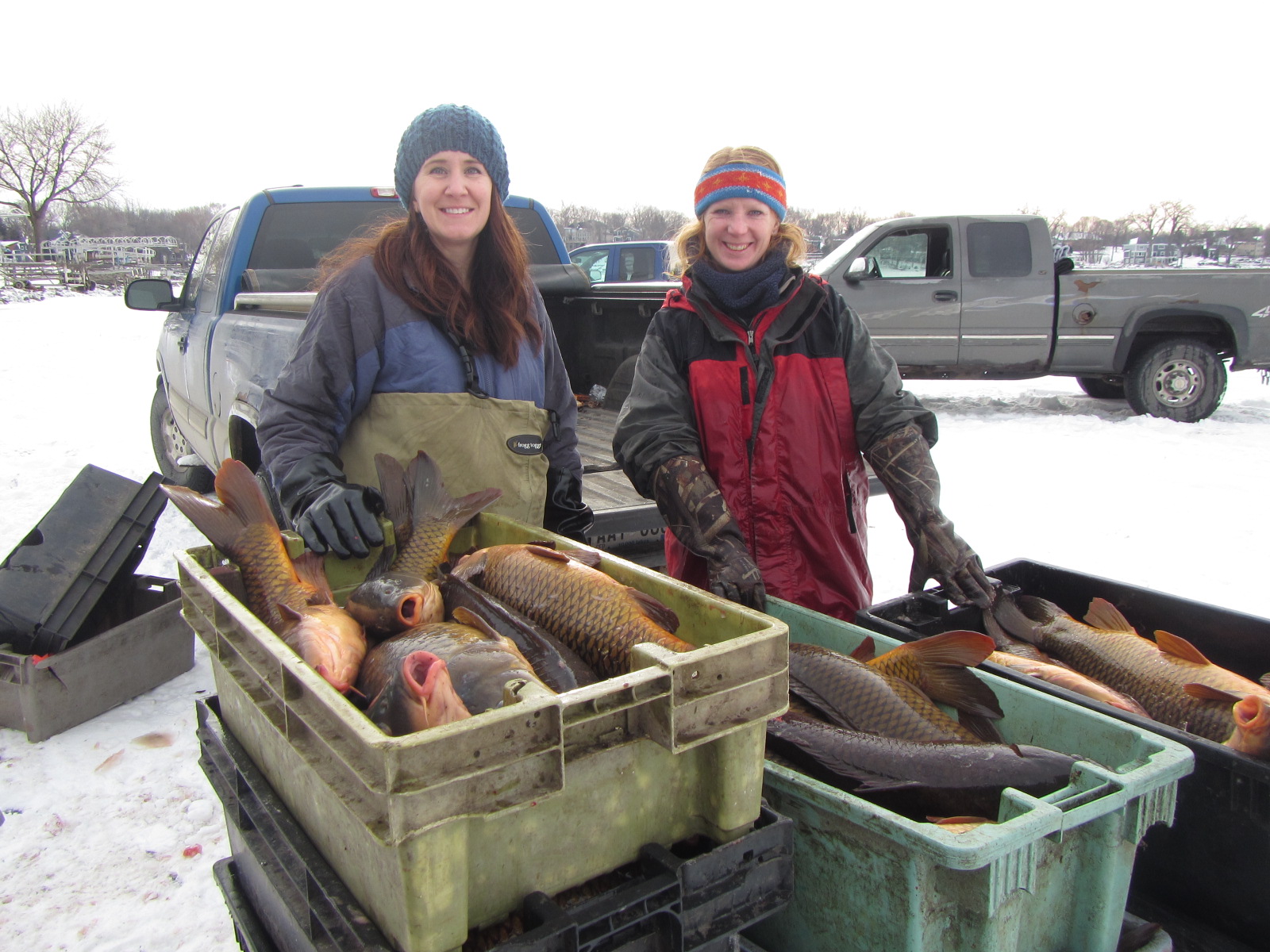
Karschnia joined the district in 2015. During her time there, she has initiated and led projects such as an Integrated Carp Management Plan that implemented innovative strategies to reduce carp populations in two impaired lakes (Spring Lake and Upper Prior Lake). She revitalized efforts to monitor conservation easements to ensure compliance with water resource protections and oversaw efforts to implement best management practices in the district. Additionally, Karschnia helped re-energize a Farmer-led Council, a group of agricultural property owners within the district, successfully partnering with them to reduce nutrient loading to meet state water quality standards.
“Maggie has an unwavering ability to recognize what needs to be done,” said Diane Lynch, former district administrator, who retired earlier this week. “She’s a scientist, she’s an environmental educator, she’s a great project manager and a leader in so many ways.”
Each year, BWSR celebrates the excellent work accomplished by local government staff to advance conservation efforts across the state. An award for Outstanding Soil and Water Conservation District Employee will be presented later this month.