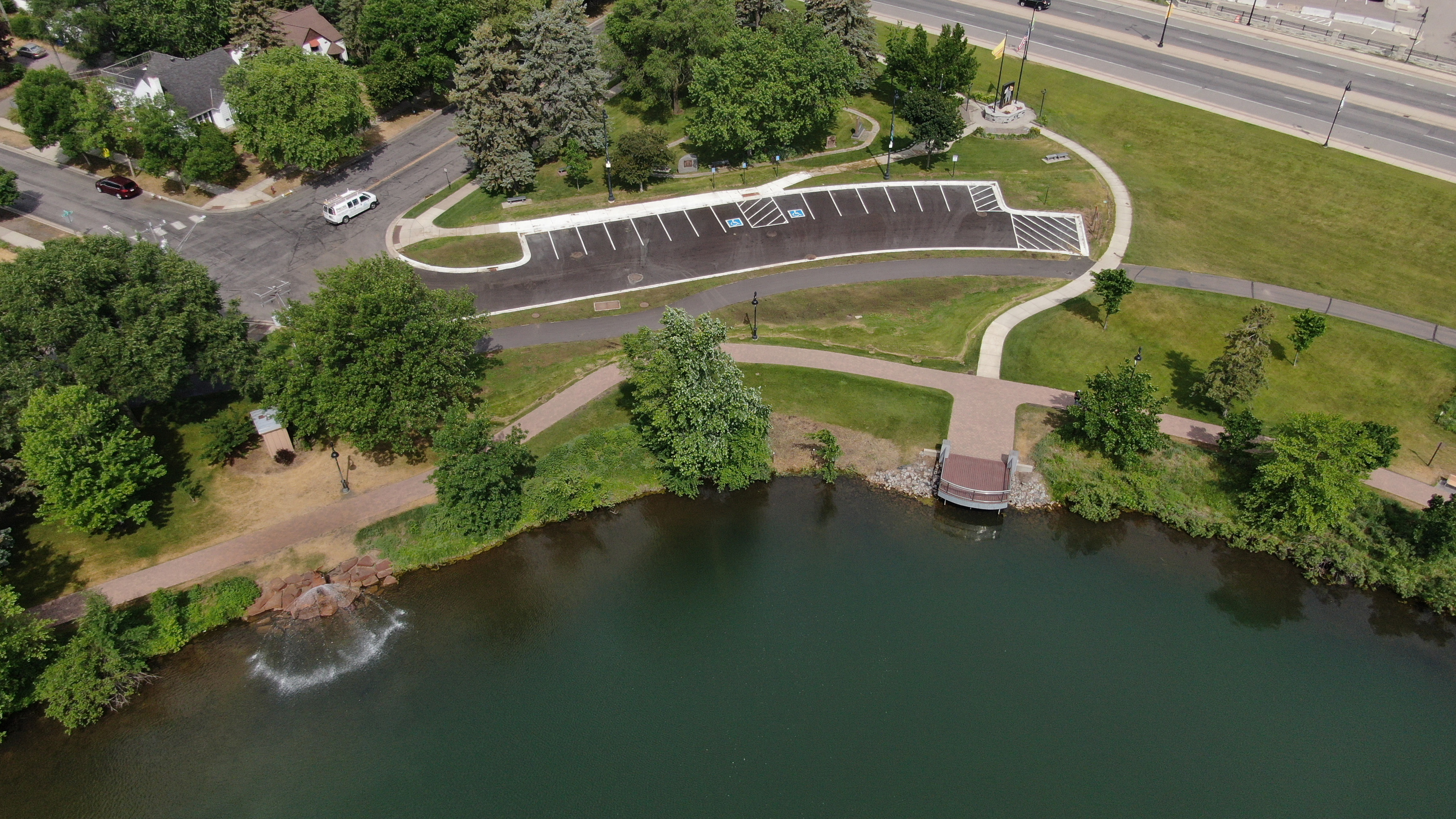
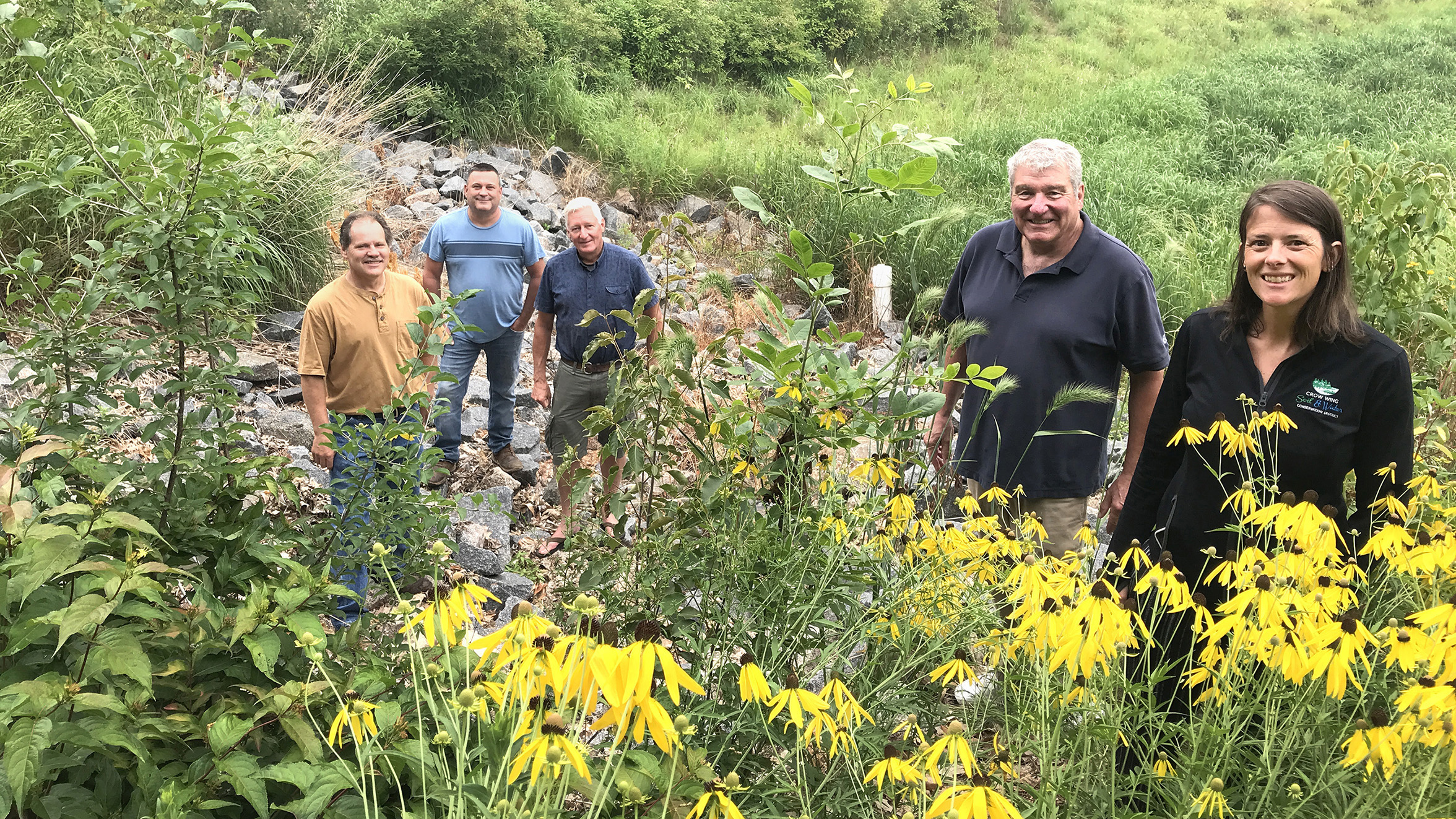
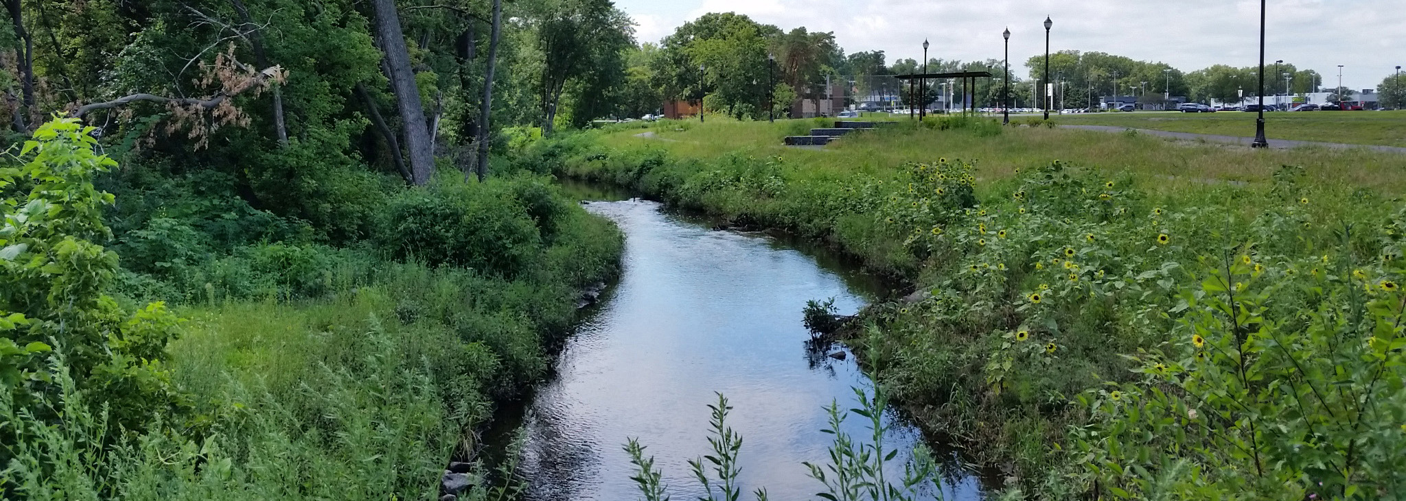
Top Bar
  • About
  • Careers
  • Contact
  • About
  • Careers
  • Contact
Search Area
    • About BWSR Grants
      • Apply for BWSR Grants
      • Frequently Used Acronyms
      • Grant Information & Resources
      • Grants Quarterly Newsletter
    • Resources for Grantees
      • eLINK
      • Grants Administration Manual
      • Landscape Resiliency & Climate Change
        • Alliance to Advance Climate-Smart Agriculture
        • BWSR Climate Resiliency Toolbox
        • Carbon Sequestration: Conservation Practices and Programs
      • What’s Working for Conservation
      • Vegetation Establishment & Management
        • Native Vegetation Establishment and Enhancement Guidelines
        • Seed Mixes
        • Native Plant ID and Information
      • Restoring Conservation Lands
      • Overview
      • Programs
      • Easement Forms
      • RIM Handbook & Guidance
      • Existing Easements
      • SWCD Resources
        • Contacts
        • RIM Interactive Map
        • Geospatial Resources
        • Conservation Lands by County
        • RIM Rundown
        • Easement Alteration Policy
      • Living Landscapes Initiative
        • Lawns to Legumes: Your Yard Can BEE the Change
        • Pollinator Pathways Grants
        • Habitat Friendly Utilities Program
        • Lawns to Legumes Partner Resources
        • Habitat Enhancement Landscape Program (HELP)
        • Pollinator and Biodiversity Toolbox
          • Community Outreach
        • Managing Invasives for a Resilient Landscape
        • Minnesota Habitat Friendly Solar Program
        • Community Conservation
      • Lawns to Legumes
      • Pollinator Pathways
      • Habitat Friendly Utilities
        • What to Plant in Buffers
      • Minnesota Buffer Law
      • Buffer Establishment & Management Toolbox
      • Guide to the Buffer Compliance Process
        • Step 1: SWCD Compliance Review
        • Step 2: Landowner Notification
        • Step 3: Notice of Non-Compliance
        • Step 4: Corrective Action Notice Sent
        • Step 5: Issuing Enforcement Action
        • Step 6: Parcel is Compliant
      • Implementation Guidance
        • Average Buffer Widths
        • Buffer Measurement for a Public Drainage Ditch
        • Building Better Buffers
        • Compliance Determinations
        • Conservation Reserve Program Exemption Guidance
        • Determining Normal Water Level
        • Determining the Top or Crown of a Bank for Land Adjacent to a Public Water
        • Haying and Grazing of Buffers
        • Vegetation Establishment Goals
      • Procedures
        • Procedure 1: Compliance Determinations (Parcel and Bank Approach)
        • Procedure 2: Reporting and Progress Tracking
        • Procedure 3: MS4 Exemption
        • Procedure 4: Alternative Practices
        • Procedure 5: Other Alternative Practices Approved by the Board
        • Procedure 6: Local Water Resources Riparian Protection ("Other Watercourses")
        • Procedure 7: Failure to Implement
        • Procedure 8: Election of Jurisdiction
        • Procedure 9: BWSR's Review of County and Watershed District Buffer Rules, Ordinances and Official Controls
      • Alternative Practices
        • Alternative Practices Introduction
        • Common Alternative Practice #1: Minnesota Agricultural Water Quality Certification Program
        • Common Alternative Practice #2: NRCS Filter Strip Standard: MN 393/391 Practice Standards - Public Waters
        • Common Alternative Practice #3: Grassed Waterway/Cultivated Watercourses - Public Waters
        • Common Alternative Practice #4A: Negative Slopes or Concentrated Inflow - Public Ditches
        • Common Alternative Practice #4B: Glacial Lake Plain Areas - Public Ditches
        • Common Alternative Practice #5: Negative Slopes or Concentrated Inflow - Public Waters
        • Common Alternative Practice #6: Conservation Tillage/Cover Crops With Vegetated Filter Strip - Public Waters
        • Decision Support Tool
      • Election of Jurisdiction
      • Enforcement
      • Compliance Tracking Tool (BuffCAT)
      • Buffer Program Update
      • Contacts
      • Soils & Soil Health
        • Model Soil Loss Ordinance
        • Tillage and Erosion Survey Project
        • Soil Health Practices Grant
      • Daily Erosion Project
      • Working Lands Resources
      • Agricultural Lands
      • Forest Land
      • Peatlands
      • One Watershed, One Plan
        • One Watershed, One Plan Participating Watersheds
        • One Watershed, One Plan Policies
        • One Watershed, One Plan Resources
        • One Watershed, One Plan Videos
      • Metro Watershed Management Plan
        • Metro State Agencies Review Roster
        • Metro Update
      • Watershed District Management Plan (non-metro)
        • Amendments and Extensions
        • Development and Revision
      • Metro County Groundwater Plan
      • SWCD Comprehensive Plans
      • Planning Information
      • Working with State Agencies
        • State Agency Review Roster for County Water Plans and Watershed Management Plans
      • Water Storage & Climate Resilience
      • Groundwater Protection
      • Urban Stormwater Management
      • Prioritize, Target, and Measure Application (PTMApp)
      • Water Quality Tools & Models
      • Drainage in Minnesota
        • Understanding Minnesota Public Drainage Law
        • Other Drainage Resources
      • Minnesota Public Drainage Manual
      • Drainage Work Group
      • Drainage Management Team
      • Drainage Records Modernization
      • Chapter 103E Ditch Buffer Strip Reporting
      • Multipurpose Drainage Management
      • Wetlands Regulation in Minnesota
      • Wetland Conservation Act (WCA) Contacts
      • Joint Application Form
      • WCA Forms & Templates
      • WCA Program Guidance & Information
        • WCA Topics of the Week
      • WCA Rulemaking
        • WCA Rulemaking Comments Received
      • WCA Program Reports
      • 404 Assumption
      • Wetland Bank Credits and Fees
      • Wetland Bank Transaction Forms
      • Wetland Bank Guidance and Information
      • Local Government Road Wetland Replacement Program
      • Agricultural Wetland Bank
      • In-Lieu Fee Mitigation Program
      • Wetland Bank & Mitigation Easements
      • Wetland Delineation
      • Wetland Functional Assessment
      • Wetland Restoration
      • Wisconsin-Minnesota Functional Assessment Initiative
      • Minnesota Stream Quantification Tool and Debit Calculator
      • Minnesota Wetland Professional Certification Program Information
      • Wetland Training Schedule and Registration
        • MWPCP Class Portal
      • Wetland Training Resources
      • Online Learning Library & Archive
      • Training Calendar
      • Technical Training and Certification Program
        • Area Technical Training Teams
        • Conservation Planning
        • Core Competency
        • Job Approval Authority
        • Technical Training Individual Development Plan (IDP) Tool
        • Technical Training Resources
      • MN Wetland Professional Certification Program Information
      • BWSR Academy
        • 2026 BWSR Academy
        • 2025 BWSR Academy
        • 2024 BWSR Academy
      • BWSR Spring Training
      • Training Updates
      • Successful Outreach Strategies
      • Performance Review and Assistance Program (PRAP) Grants
        • PRAP Grants
        • Conservation Project Planning and Promotion
          • Inspections
        • Invasive Species Control
        • Native Vegetation
        • Pollinator Habitat
        • Prairie, Savanna, Forest and Agricultural Projects
        • Stormwater, Shoreline and Wetland Projects
      • Standard Reviews & Checklists
        • Vision for Native Vegetation and Biodiversity
        • FY25 Conservation Reserve Program State Incentives Grant Program
        • MN Wetland Restoration Guide
      • PRAP Legislative Reports
    • About BWSR
      • What We Do
      • Board
      • BWSR Executive Leadership
      • Staff
      • Strategic Plan
        • Engagement Process
      • Diversity, Equity and Inclusion
      • Affirmative Action Plan
      • Legislative Resources
      • Careers
      • Contact Us
    • About Our Partners
      • Soil and Water Conservation Districts
      • Watershed Districts
      • Watershed Management Organizations
      • Counties
      • Cities and Townships
      • Regional Partnerships
    • News & Publications
      • Subscribe
      • News Releases
      • BWSR Story Library
      • Conservation Stories
      • BWSR Snapshots
        • Snapshots Archive
      • Featured Plant
        • Featured Plant Archive
      • Reports

Search

  1. Home
  2. Search

2020 August Snapshots

Climate Change Vulnerability and Adaptation of Forest Wildlife

Climate change is affecting the species and communities that make up our forests in a myriad of ways. Dr. Morelli will present a synthesis of the impacts of climate change on the wildlife of the forests that cover much of the Midwest and northeastern U.S. Based on a mix of expert elicitation and literature review, she will show what species are predicted to be most vulnerable to climate change, as well as the uncertainty around those predictions. Tools to incorporate the latest science into management decisions in order to achieve climate change adaptation will also be reviewed.

Presentation Objectives:
     (1). Learn about the current and future impacts of climate change on forest wildlife
     (2). Gain knowledge about which forest species might be most vulnerable to climate change (and why).
     (3). Receive a list of tools for implementing climate change adaptation actions into management of forest wildlife.  

Subject TTCP
Advanced Tech Skills (Matrix)
Skill
Forest Ecology and Management
Format
Webinar
Source

USFWS

Date
August 03, 2020
Time
51:03
Training Type
Online Learning
Location

United States

Online Location
Climate Change Vulnerability and Adaptation of Forest Wildlife

Emulating Forest Disturbance with Silviculture

The U.S. Fish and Wildlife Service has developed a Forest Ecology and Management course focused on advancing knowledge and skills for USFWS biologists, foresters and others who manage forests on refuges or partner lands to meet wildlife habitat needs and objectives. This webinar is an overview of the course which is designed to introduce biologists and others to the concepts of forest disturbance ecology, basic silvicultural approaches and the design of silvicultural prescriptions that will either emulate conditions more typical of natural disturbances or meet the needs for a particular set of species. The course covers field skills, stand exams, forest dynamics modeling, cruising, marking and harvesting. The course and presentation focus on using emulation of natural forest disturbances as a main thesis.

Subject TTCP
Advanced Tech Skills (Matrix)
Skill
Forest Ecology and Management
Format
Webinar
Source

USFWS

Date
August 03, 2020
Time
56:44
Training Type
Online Learning
Location

United States

Online Location
Emulating Forest Disturbance with Silviculture

Re-created Trout Brook Nature Sanctuary stream aids water quality

Conservation Story Image
fisheye view of landscape
Conservation Story File
Media File
CRWD Trout Brook 2021.pdf
Conservation Story Text

St. Paul Parks and Recreation, Capitol Region Watershed District staff's Clean Water Fund supported work at Trout Brook Nature Sanctuary treats stormwater; attracts people, animals to habitat on site of former rail yard

Conservation Story Featured
Off

Building a productive pasture: NRCS rotational grazing in Pope County

Conservation Story Image
Jennifer Olson extends a hand to beef cattle in a pasture
Conservation Story File
Media File
NRCS Pope County grazing 2021.pdf
Conservation Story Text

With NRCS rotational grazing plan and EQIP assistance, Pope County beef producer improves forage on former CRP enrollment, anticipates water-quality benefits

Conservation Story Featured
Off

Le Sueur County SWCD advances chain of lakes water quality work

Conservation Story Image
Hogs perk up their ears
Conservation Story File
Media File
Le Sueur County SWCD Jefferson German CWF 2020.pdf
Conservation Story Text

In a watershed that feeds the Cannon River, Clean Water Funds from BWSR, cooperation from landowners and support from the Greater Jefferson German Lakes Association result in prioritized phosphorus reduction practices

Conservation Story Featured
Off

Lake of the Woods SWCD ditch fix targets sediment-filled Bostic Bay

Conservation Story Image
Lake of the Woods SWCD and County staff stand in front of a segment of Judicial Ditch 28 before construction began
Conservation Story File
Media File
LOTW Bostic Creek JD28 2020.pdf
Conservation Story Text

Clean Water Fund project also protects northern pike spawning habitat

Conservation Story Featured
Off

Water quality work in N. St. Paul, Maplewood, protects Silver Lake

Conservation Story Image
Two anglers fish from a pier on Silver Lake
Conservation Story File
Media File
VBWD Silver Lake CWF.pdf
Conservation Story Text

Valley Branch Watershed District's Clean Water Fund project focuses on phosphorus reduction by treating stormwater before it reaches lake known for public boat launch, fishing, swimming beach

Conservation Story Featured
Off

Pagination

  • First page « First
  • Previous page ‹ Previous
  • Page 7
  • Page 8
  • Page 9
  • Page 10
  • Current page 11
  • Page 12
  • Page 13
  • Page 14
  • Page 15
  • Next page Next ›
  • Last page Last »

Useful Links

  • BWSR Maps and Apps Gallery
  • Careers
  • eLINK
  • Staff
  • Subscribe
  • Webmaster Email

Connect with Us


Clean water land and legacy amendment program logo

BWSR's work is supported by Clean Water
Land and Legacy Amendment Funding

MN Board of Water and Soil (known as BWSR) logo

BWSR agency programs that assist landowners and local government have resulted in less sediment and nutrients entering our lakes, rivers, and streams; more fish and wildlife habitat; and the drastic slowing of wetland losses.

The Board of Water and Soil Resources is an equal opportunity employer.

Main Address:
520 Lafayette Road North
St Paul, MN. 55155
Phone: 651-296-3767
TTY: 800-627-3529
Email: info.BWSR@state.mn.us

BWSR Office Locations


© Copyright 2026 Minnesota Board of Water and Soil Resources

Accessibility   |   Affirmative Action Plan   |   Download Adobe Acrobat Reader   |   Sitemap