
Introduction
There are a variety of methods that can be used to increase landscape and hydrological resiliency in agricultural areas. BWSR promotes conservation practices in agricultural areas that promote soil health and the ability of soils to capture and store rainfall, store carbon and decrease heat absorption. Conservation practices that minimize impacts from larger storms are highlighted in this section of the toolbox, including cover crops, field terraces, no-till farming, buffer strips, retention areas, and constructed wetlands. Conservation drainage and drainage water management practices are also key strategies to address water quality and quantity concerns. These practices can reduce runoff and nutrient loss, avoid runoff concentration, protect areas where runoff concentrates, reduce peak flows to reduce erosion, maintain agricultural productivity, improve water quality and habitat, and reduce flooding. Multipurpose drainage practices help make working lands as well as artificial and natural drainage systems more resilient to high intensity rainfall.
Agricultural water management practices can have the added benefits of improving soil health, carbon sequestration, improving food security, and strengthening local economies.
Planning Programs and Tools
A major climate trend in Minnesota has been an increase in intense rainfall events that stress aquatic systems and cause erosion. Partners that are working on water planning and conservation projects should consider the potential for more extreme weather events and the implication for water and land resources. BWSR’s Climate Change Trends and Action Plan (pdf) provides detail about climate change adaptation for conservation and protection of natural resources. All of the strategies summarized in this section of the Toolbox play a role in climate adaptation efforts. In addition to the strategies already summarized, it is also important that NOAA Atlas 14 rainfall frequency data and best management practices in landscape planning and design are used to address larger storm events. It is also important to identify landscape and populations at risk from climate change trends.
Local Water Planning: One Watershed, One Plan, County Comprehensive Local Water Management Plans, watershed district management plans, and watershed management organization plans are critical tools for addressing water quality and other water resource concerns in Minnesota. Most if not all of these plans address water management in and around agricultural lands.
Stream Power Index: This measuring tool developed by the Natural Resource Research Institute (University of Minnesota - Duluth) calculates the erosive power of overland water flow as contributed by slopes, terrain zones and soils. Critical areas are assigned a percentile to depict the appropriate level of risk.
PTMApp: This application, the “Prioritize, Target and Measure Application,” considers resources and issues impacting Soil and Water Conservation Districts, Watershed districts, county, and agency decision makers using LiDAR data to determine best management practices and conservation practices. Capable of “measuring” the effectiveness of BMPs and CPs, the PTMApp is a powerful tool for tailor-made results to protect or restore resources.
Minnesota Agricultural Water Quality Certification Program: The Minnesota Agricultural Water Quality Certification Program (MAWQCP) is a voluntary opportunity for farmers and agricultural landowners to take the lead in implementing conservation practices that protect our water. Those who implement and maintain approved farm management practices are certified and in turn obtain regulatory certainty for a period of ten years.
Field to Market: The Alliance for Sustainable Agriculture is a diverse collaboration working to create opportunities across the agricultural supply chain for continuous improvements in productivity, environmental quality, and human well-being. Tools such as the Fieldprint® Platform have been developed to measure the environmental impacts of commodity crop production and identify opportunities for continuous improvement.
Key Strategies
A key need in agricultural areas is to decrease landscape stressors. Storms cannot be avoided but some conservation practices can decrease their impact. The following are among the key strategies that can be used in agricultural areas to increase resiliency, including several agricultural conservation practices that are key to dealing with an increase in larger storm events, such as conservation tillage, field terraces, buffers, controlled drainage, water and sediment control basins, grade stabilization and wetland restoration.
- Use Multiple Layers of Water Treatment. In agricultural areas it is beneficial to implement a variety of practices that promote soil health and the ability of soils to capture and store rainfall, store carbon and decrease heat absorption from tilled ground. Examples of key practices that are often combined include perennial crops, conservation tillage, conservation drainage, cover crops, buffer strips, and wetland restoration to manage water resources. These practices reduce runoff, recharge groundwater, maintain agricultural productivity, improve water quality, and reduce flooding.
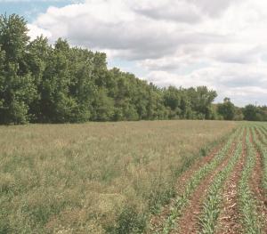
 Cover Crops for Soil Health. Cover crops are grasses, legumes or other herbaceous plants that are planted to protect soils from erosion during seasons which the soils would otherwise be bare. Cover crops also add organic matter, suppress weeds, pest and soil diseases, fix nitrogen, attract beneficial insects and promote biodiversity, reduce surface evaporation, and retain moisture. Use cover crops and perennial vegetation in degraded soils to promote good soil structure, organic content and microorganism populations that translate into healthy soils that promote productive ecological and agricultural landscapes.
 - Crop Rotations. Rotating crops involves a planned succession of plantings, growing primary crops followed by at least one soil-conserving crop like perennial hay or small grains on the same field. When implemented together with nutrient management, conservation tillage and/or grassed waterways, crop rotation is most effective at erosion and runoff control.
- Conservation Tillage. This beneficial tillage system leaves at least 30% residue from the previous year’s crop on a field as coverage, improving soil nutrients, increasing organic matter and water-holding capacity, decreasing erosion from wind and rain, and extending the productivity of the soil.
- Field Terraces. For slopes 5% or greater, these earthen embankments intercept and slow surface water flow by capturing water in a built channel (on the contour) and effectively move the water off of unprotected slopes via a vegetated waterway or underground pipe outlet. While more expensive upfront, field terraces can be an effective method of water removal during large storm events.
- Water Quality Buffers. Designed to intercept water runoff and pollutants, these vegetated strips capture snow melt, sediment, nutrients and pesticides. Buffers slow water, reduce risk of flooding downstream and equipment rollover due to set backs from ditches, and stabilize streams by reducing bank erosion. With the addition of tall shrubs and trees in a buffer strip, shade can provide habitat for local wildlife and improve conditions for fish as well. Types of buffers can include grassed waterways, filter strips, riparian buffers, contour buffer strips, field borders, and wetlands.
- Use of Controlled Drainage. By collecting water and manipulating the levels harvested, controlled drainage can be a successful methods of moderating precipitation-related stress on plants during flood or drought periods. It can also improve water infiltration, reduce the loss of nutrients and lower chemical concentration in groundwater.
- Implementation of WASCOBs and Detention Basin. A “Water and Sediment Control Basin” (WASCOB) is a sediment erosion control practice that uses a series of small engineered embankments which slowly release runoff, allowing sediment time to settle out. Detention basins provide larger detention areas that also play an important role in detaining water following larger storms and collecting sediment.
- Use of Grade Stabilization. By using grade stabilization(pdf) structures like spillways across drainage ways, stormwater flow is slowed assisting in the prevention of gully erosion. With planning, it can also be combined with WASCOBs to create habitat for local wildlife and improved water quality.
- Wetland Restoration. In many agricultural lands, wetlands have previously been drained, farmed and or modified. By restoring wetland hydrology, plants, groundwater interaction and sediment levels can be improved. Erosion and flood damage can also be decreased as well as the treatment of nutrients, pesticides and bacteria prior to moving down stream.
- Use of Multipurpose Drainage Management. Conservation drainage and drainage water management practices can help reduce peak flows to reduce erosion, maintain agricultural productivity, improve water quality and habitat, and reduce flooding. Multipurpose drainage practices help make working lands as well as artificial and natural drainage systems more resilient to high intensity rainfall.
- Promoting Perennial Crops for Biomass and Other Products. Perennial crops such as intermediate wheatgrass (Kernza) and winter annual cover crops (oilseeds such as camelina and pennycress) can be used for food products, livestock feed and bedding, soil supplements, biofuels, and biobased products such as plastics and building materials. The Forever Green Initiative at the University of Minnesota is leading efforts to develop and market such crops, and the Agricultural Utilization Research Institute is a source of information on emerging products and trends. See also Working Lands Resources.
- Restoring Perennial Vegetation. Planting areas of diversity supports wildlife species and increases resiliency by helping plant communities continue to function as intact systems during climate variation. Planting native species also prevents the establishment of invasive species. Diverse state seed mixes are available for a variety of project types and the Minnesota Wetland Restoration Guide summarizes restoration strategies for uplands and wetlands.
- Developing Sustainable Plantings. Matching targeted vegetation to the native plant community that best fits site conditions will add to resiliency. Also restore natural hydrologic regimes to aquatic and wetland systems. Historic plant community information can be used as a guide for decision making. Determine the kinds of native wildlife that can benefit from the project and include native plants that will provide food and shelter for many animal species.
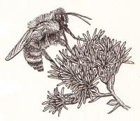
- Providing Habitat for Pollinators and other Beneficial Organisms. Pollinators and other insects and organisms play an essential role in supporting ecosystems. Pollinators provide seeds and fruits that are relied on by a wide range of wildlife by pollinating around 70% of flowering plants. Support insect and soil microbes by minimizing pesticide use, buffering natural areas and diverse plantings from pesticide exposure, restoring habitat complexes and wide natural corridors, increasing plant diversity, and restoring clean water sources. BWSR’s Pollinator Toolbox provides guidance for projects and the state's interagency pollinator protection team coordinates activities implementing Governor Walz’s Executive Order 19-28, which recognizes pollinators as important to Minnesota's economy, ecology, and way of life and directs state agencies to restore pollinator health in Minnesota.
- Using Integrated Pest Management Strategies. Integrated Pest Management (IPM) involves the use of a variety of control methods to manage pests while decreasing the use of herbicides and pesticides or providing practices for their use. These methods help decrease impacts to pollinators, aquatic species and other organisms.
- Managing Invasive Species Across Boundaries. Invasive species are effective at dispersal, giving them an advantage in adapting to climate change. Plan to work in partnerships and manage invasive species across ownership boundaries to restore resilient landscapes.
- Engaging Landowners. Workshops that include farmers as presenters, public meetings, discussion groups, landowner meetings and social media are all ways to include landowners in agricultural planning efforts and engage them in the implementation of strategies to protect and restore natural resources. A guide titled “Inspiring Action for Nonpoint Source Pollution Control” provides a detailed discussion about ways to engage the public.
 Cover Crops for Soil Health.
 -
Case Studies
-
Sustainable Conservation Practices for Healthier Water and Soil – A Farmer-Led Approach. Benefits of upland conservation practices are of interest to farmers and landowners, as the Faribault County Soil & Water Conservation District (SWCD) discovered. This 2017 article describes how outreach and education by the Faribault County SWCD in areas such as cover crop and no-till practices are being designed based on communication, direct requests, and involvement from local farmers and landowners.